The roads may not be paved with yellow brick, but the charming neighborhoods of Lafayette form the East Bay’s version of an Emerald City. From the pastoral, private estates of Happy Valley to the tree-lined, ranch house cul-de-sacs of Burton Valley, Lafayette offers its residents a welcome retreat from the urban energy that surrounds this Shangri-La.
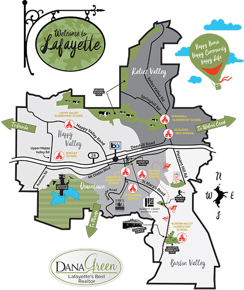
Though we’ve simplified the topography just a bit, this map provides a generalized view of Lafayette and its distinct neighborhoods that are easily defined by our four elementary schools. While each quadrant features a distinct personality, the four unite to make a community that is truly greater than the sum of its parts.
We’ve featured a few highlights on our map – the places in town that provide a social and communal hub. The Lafayette Reservoir, for instance, is where you will find friends and family strolling the bucolic 2.7 mile paved path. You’ll know it’s spring when Lafayette Little League’s Buckeye Fields come alive with spirited youth swinging for the fences. And our 7.6 mile Lafayette-Moraga regional trail is shared by bikers, runners, and dog-walkers.
Use our map as a starting point for discovering Lafayette, then give us a call. We can’t wait to show you the real thing.


